OKEAN-O
Note: This satellite is no longer active
Image Formats
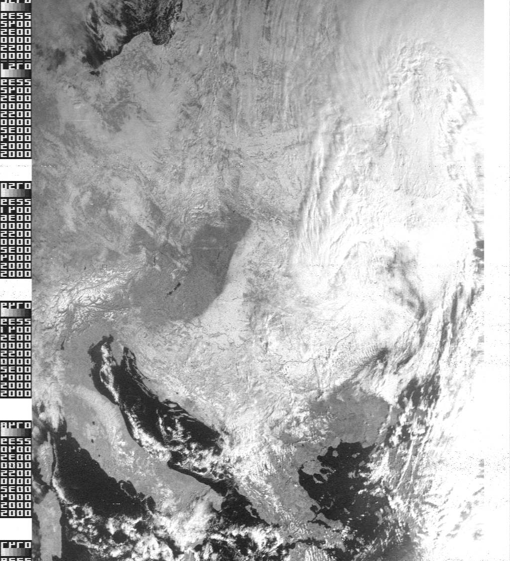
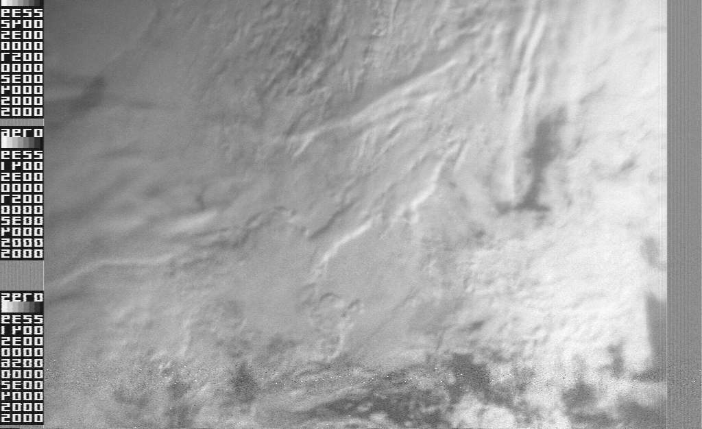
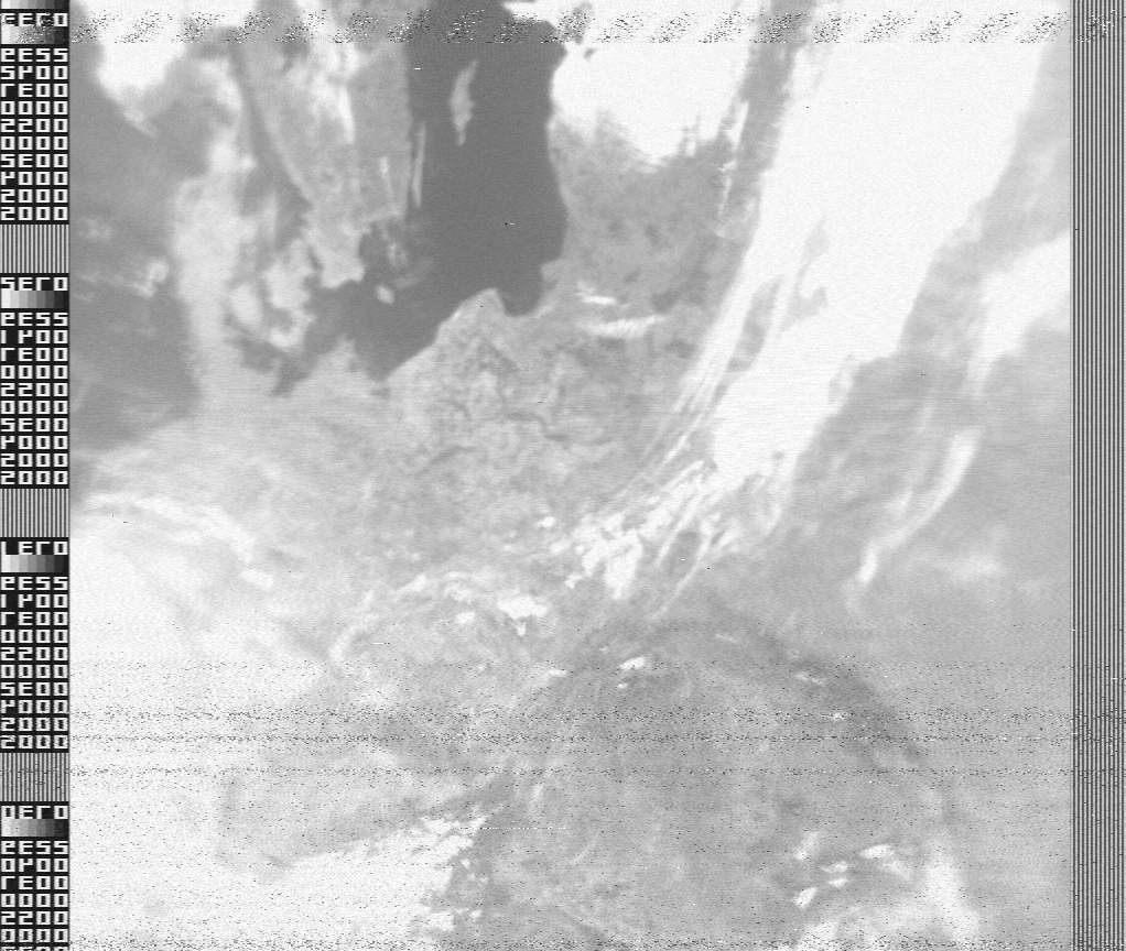
Okean-O images were transmitted in four different formats, presumably corresponding to the four different wavelengths available to its MSU-M sensor. For convenience, I am labelling these Types I to IV, and these can be identified by the continuous margin at the left-hand edge of the received images.
Type I - Solid white band

Type II - Solid grey band
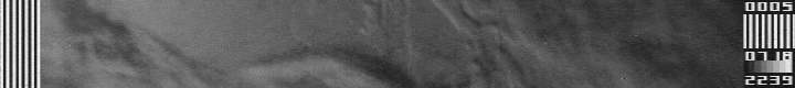
Type III - 7 white stripes
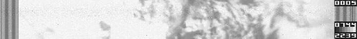
Type IV - 12 or 13 white stripes
Type I images were invariably sharp, and show excellent detail of both land and cloud features. They are recognisable by their broad white edge band. It seems reasonable to suggest that Type I images, which resemble closely the NOAA channel-2 images, are produced using the 0.8 to 1.1 micrometre waveband. Type II and Type III images were very similar to each another, both showing appreciable blurring, and lower contrast than Type I. Type IV images had a bland, milky appearance, and were often predominantly white, showing only very indistinct, blurred, grey features. They showed almost no cloud texture at all.
Okean-O visible images were always transmitted laterally inverted. The examples below have all been mirrored to show them in the correct orientation. As a result, the distinguishing features described above now appear on the right-hand side of each image
| February 27, 2001 | June 27, 2000 |
|---|---|
| Type I image
|
Type III Image
|
January 30, 2001 | May 2, 2001 |
| Type II image
|
Type IV Image
|