Mars High Resolution Mapper
Mars High Resolution Mapper makes use of the highest resolution digital elevation data acquired by the Laser Altimeter flown aboard the Mars Global Surveyor (MGS) spacecraft.
This software requires the MEG128 data set which consists of 16 tiles that provide 128 pixels per degree resolution over the entire surface of the Red Planet.
You can download a copy of these large, 126 MB files from:
http://pds-geosciences.wustl.edu/missions/mgs/megdr.html
Note
You require to download only the sixteen 'Topography' files of type '.img'.
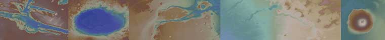
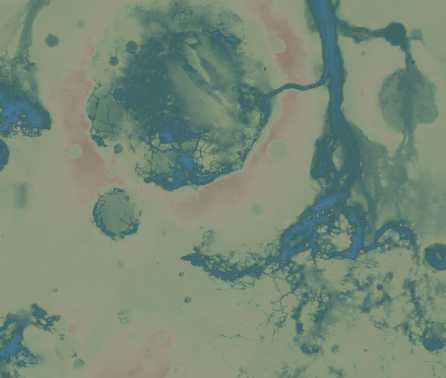
Mars High Resolution Mapper allows the user to select from a wide range of predefined regions of the Red Planet (Plains, Plateaus, Mountains, Channels etc.), as well as enter coordinates for a user-defined area. A range of colour palettes is available.
Mars High Resolution Mapper runs under all versions of Windows from XP to W10. It requires a minimum 1024×768 PC screen.
This page has been accessed times.
Counter supplied by