
ETOPO2 Mapper
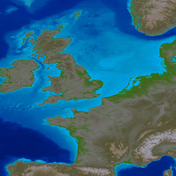
ETOPO2 Mapper is a program that draws on the digital elevation data from the latest version of the NOAA/NGDC Earth topography database file, which contains 2-minute gridded global relief data for the entire surface of the Earth, including the ocean floor. This datafile is designated ETOPO2v2 (June, 2006). You can download a copy of this 114 MB file (as a 70 MB download) from: http://www.ngdc.noaa.gov/mgg/global/relief/ETOPO2/ Click the map of the North Sea opposite to see the full resolution of ETOPO2 Mapper. |
 |
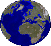
ETOPO2 Mapper allows the user to select from a wide range of predefined regions of the Earth as well as enter coordinates for a user-defined area. A range of colour palettes for both land elevation and bathymetry are available. This is a completely new version of the program, coded in Delphi (2007). Full Earth maps may be manipulated using David Taylor's GroundMap software to create globes of the world from any aspect, as illustrated opposite. ETOPO2 Mapper has been designed under Windows 2000, and also runs under Windows XP. It requires a minimum 1024×768 PC screen. |
 |
Please e-mail any comments to
Note: This is not a link - you have to type this address into your e-mail client. | |