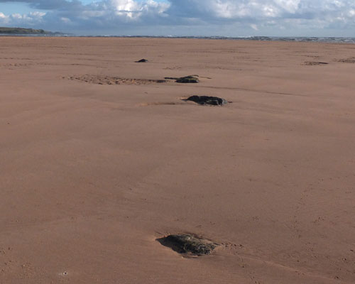
Forvie Stone CircleLocated 250 metres south of the pill box (lower black marker) at the southern tip of Forvie Dunes.Following a storm in early 2011, which removed a considerable depth of sand, a set of stones was revealed on the strand, just north of the estuary of the River Ythan. It was first spotted by John Hughes, who realised that this setting of stones, in an area otherwise devoid of rocks, possessed many of the characteristics of a Recumbent Stone Circle, and he described it on this web page. John has produced a detailed, illustrated report on his findings, and this is available as a PDF document from a link on his page. But one significant feature was missing, a recumbent stone. However, lying just over a kilometre north-northeast of this location is a huge stone measuring fractionally under three metres long by two wide, a stone that would not look out of place as the recumbent in many a North-East stone circle. The gap between the likely flanker stones of the circle was measured, and found to be an exact fit (to within 10 centimetres), possible evidence that this could once have been the circle's recumbent stone before somehow becoming displaced from its original position. The BING map below shows the GPS locations established for all the stones that were visible at the time of my visit (red markers). The upper black marker indicates the spot where the waymarked path emerges from the dunes on to the sands, just 50 metres from the recumbent; the lower black marker denotes the prominent pill box, which is a useful guide to the position of the circle (it's just visible in the panoramic photograph below beyond the large stone, farthest away in the middle of the scene ). These stones are deeply buried in the sand, and in most cases only their tips show. But probing around even the smallest of them indicates that they are all very substantial indeed. As the sands swirl in the tides, stones may appear or disappear between successive visits to the site. All the stones indicated on the map will not necessarily be visible at the same time. A full-size map of the site can be found here, where you can click over the markers to view photos of the stones. | |
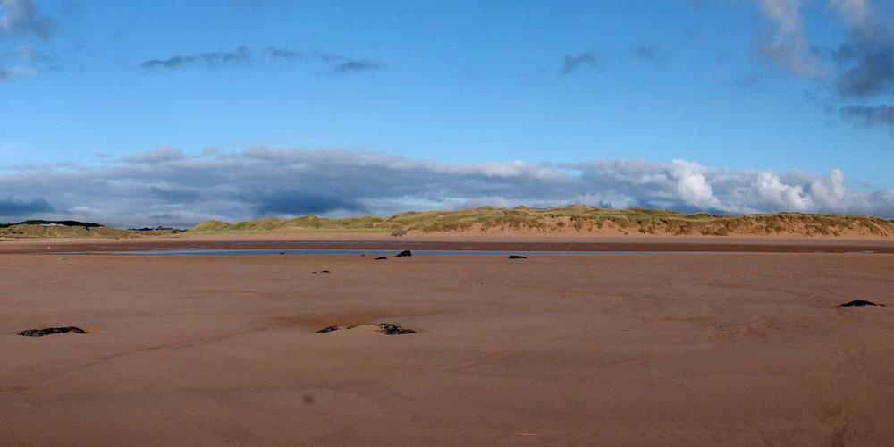 | |
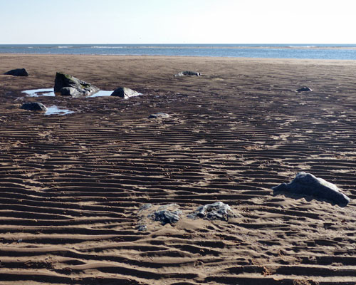
| A panoramic view across Forvie Stone Circle, largely buried under the sand | |
 |
|
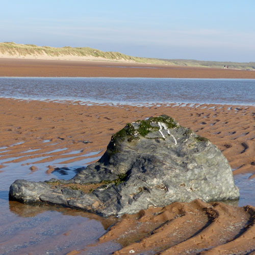
| This is the largest of the stones at Forvie Stone Circle | This map indicates the GPS locations of the Forvie stones |
 |
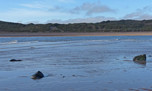 |
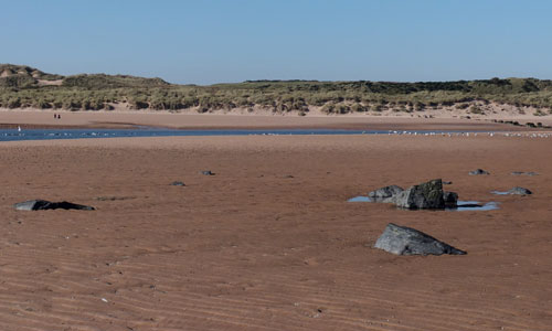
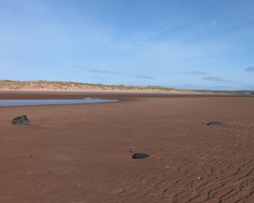
| Looking west across the Forvie stones, the River Ythan in the background. | Two hours after Low Water, the rising tide washes over the stones. |
 |
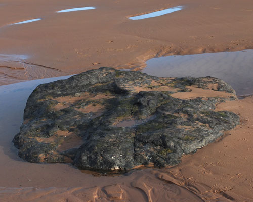 |
| The four stones on the southern arc. The distance been the two central stones almost exactly matches the maximum width of the recumbent. | The putative recumbent stone, measuring 2.86×1.96 metres, which now lies a kilometre distant from the circle. |
 |
 |
| On a "low sand" day, stones to the west of the circle, often buried and unseen, break the surface. | A week later it's a "high sand" day and only the tips of the largest stones can be seen. |