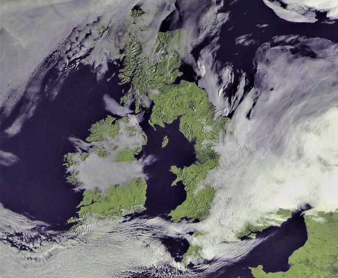
British Isles on April 25, 2021
Shapes=0, no overlay applied |

British Isles on April 25, 2021
Shapes=1, Coastline overlay applied |
British Isles on April 25, 2021
Shapes=2, Country boundary overlay applied |

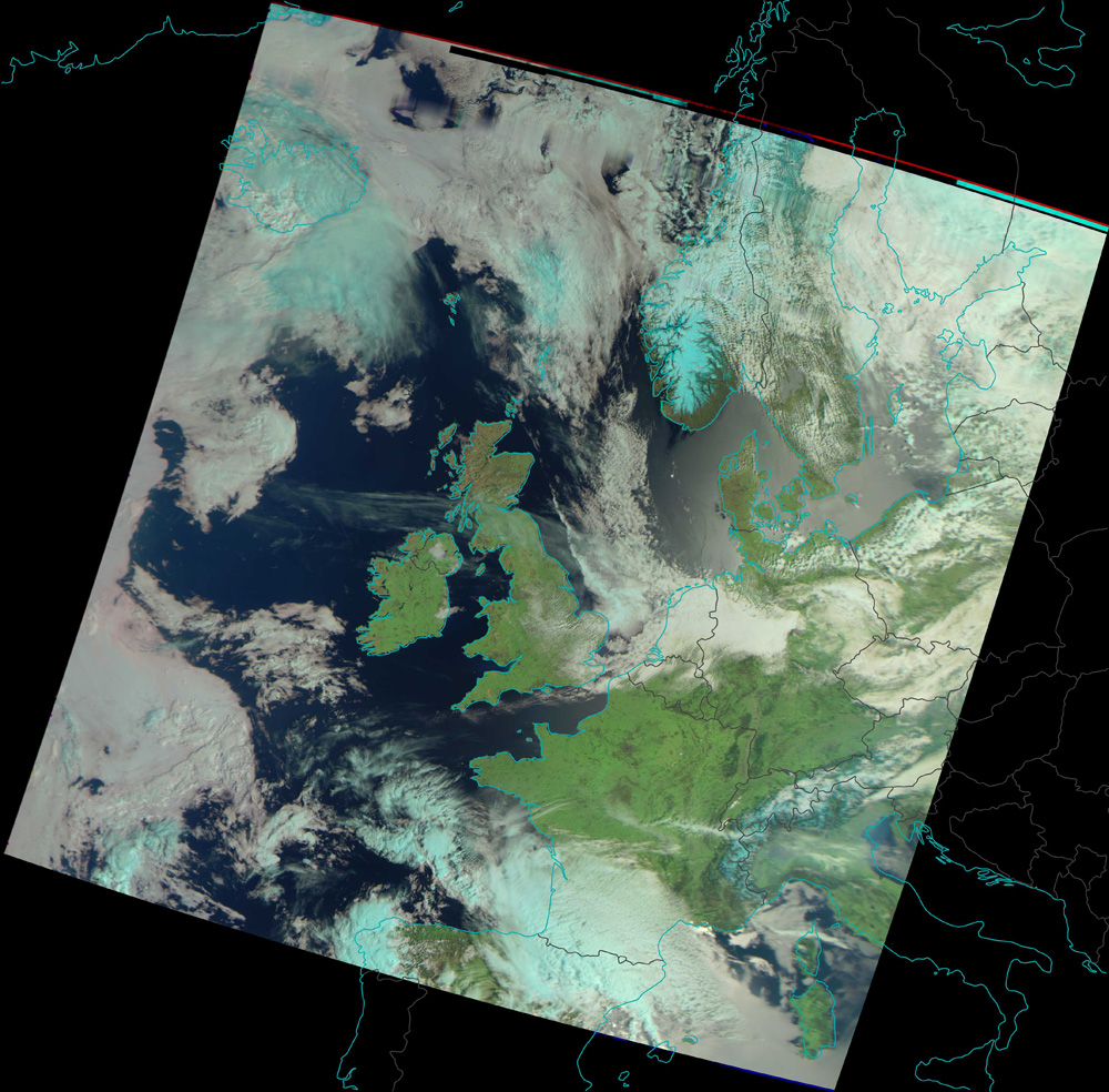
British Isles on April 25, 2021
Shapes=3, Latitude/Longitude Grid overlay applied |
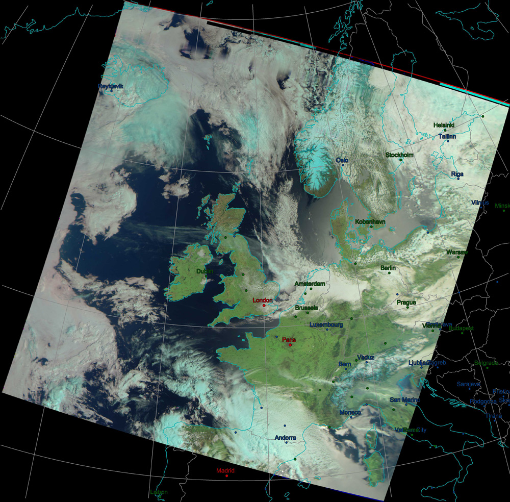
British Isles on April 25, 2021
Shapes=4, Major City overlay applied |
Winter images (Meteor channels 1, 2 and 5)With infrared channel No 5 replacing visible channel 3, different composite images are possible. |
British Isles on March 20, 2021
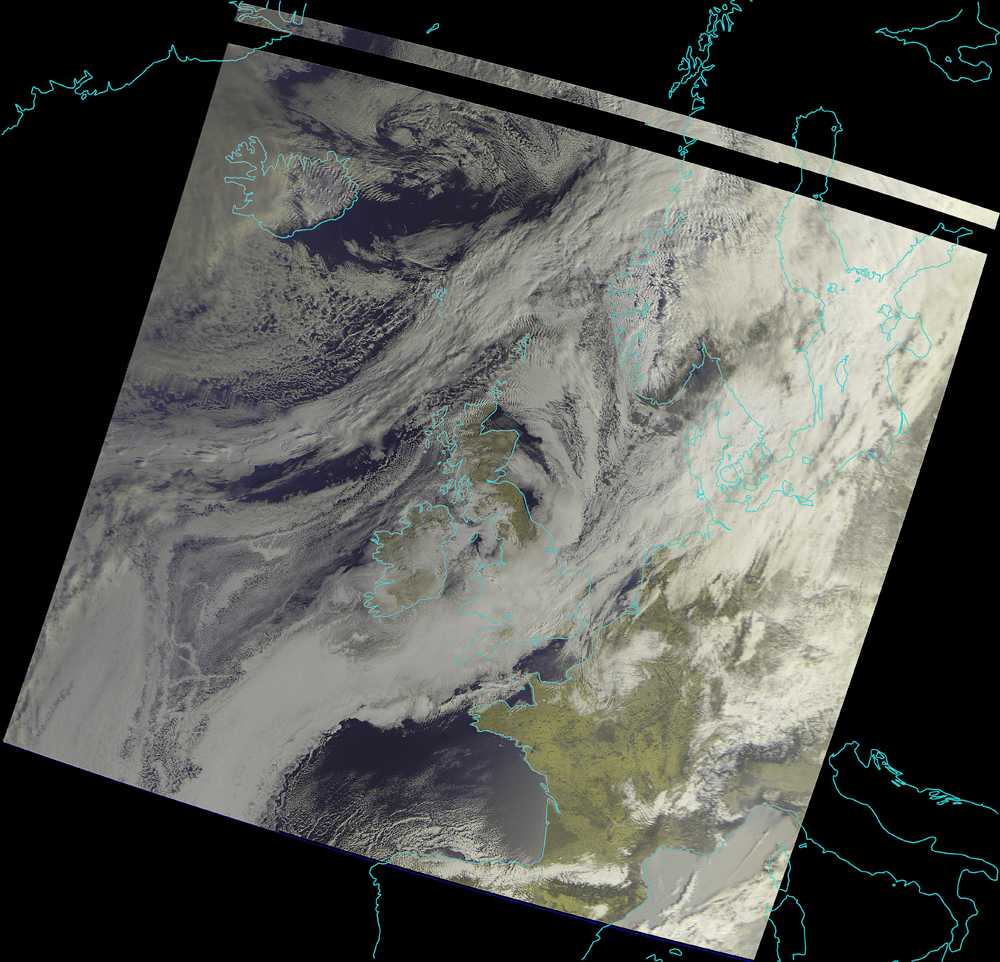
With only two visible channels available, this is the RGB122 colour composite image |
British Isles on March 20, 2021
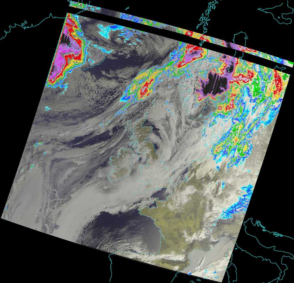
This is the RGB122 colour composite image with a rainfall overlay generated from a colour palette |
British Isles on March 20, 2021
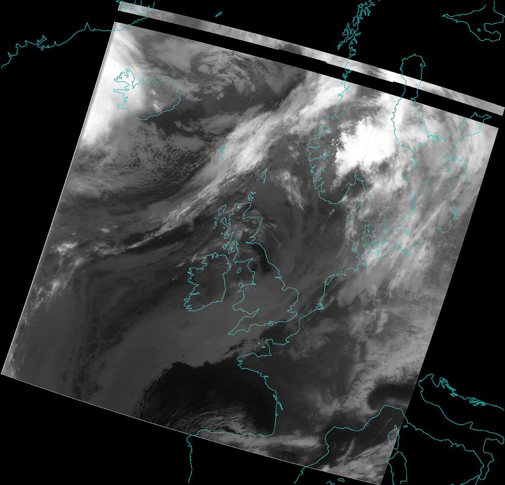
This is the channel-5 Infrared Image |
British Isles on March 20, 2021
This is the channel-5 Infrared Image with rainfall overlay |
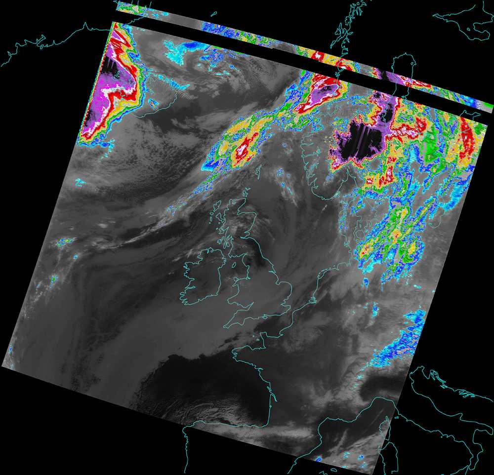
British Isles on March 20, 2021
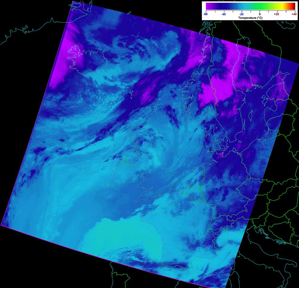
This is the false colour thermal image with optional temperature scale |
Return to previous page |
This page has been accessed  times. times.
Counter supplied by 
|